


Vauban et les eaux de la Montagne Noire

tabouelle
User
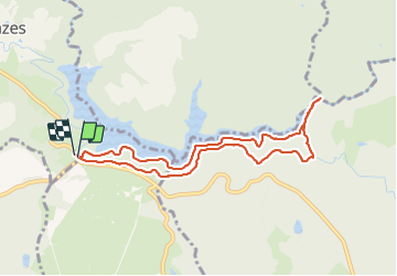

Length
8.6 km

Max alt
647 m

Uphill gradient
146 m
Km-Effort
10.6 km

Min alt
575 m

Downhill gradient
149 m
Boucle
Yes
Creation date :
2023-09-08 07:02:25.594
Updated on :
2023-09-08 09:52:47.379
2h21
Difficulty : Very easy

FREE GPS app for hiking
 SityTrail
IGN / Geographical institutes
SityTrail Plus
The world is yours!
About
Trail Walking of 8.6 km to be discovered at Occitania, Tarn, Les Cammazes. This trail is proposed by tabouelle.
Description
à faire par temps chaud car très ombragé et proche de l'eau
Positioning
Country:
France
Region :
Occitania
Department/Province :
Tarn
Municipality :
Les Cammazes
Location:
Unknown
Start:(Dec)
Start:(UTM)
426769 ; 4805263 (31T) N.
Comments